ARLINGTON — City of Arlington officials explored its natural and urban resources during a tour of its parks and streets on Thursday, April 26.
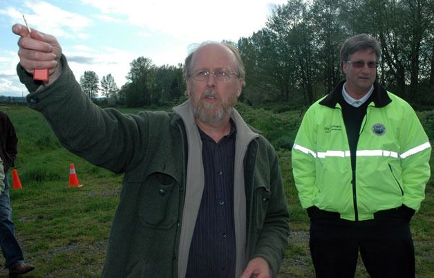
City Natural Resources Manager Bill Blake led the three-van caravan through their riverfront master planning tour starting with the stormwater park adjacent to Haller Park.
Blake suggested that part of the grassy areas could be utilized as an off-leash dog park, while he explained how the stages of stormwater filtration, from wetlands and future forests to gravel, have already reduced the sediment going into the Stillaguamish River by two-thirds.
“In 10 years, you won’t even be able to see across this park,” Blake said, noting that the seedling trees would grow quickly and thickly.
Blake acknowledged that contractors had not set the wetland at the proper level, but assured his fellow city officials that the adjustments would not cost extra. The level adjustment will make the stormwater park better prepared to handle flooding.
Blake and city Recreation Manager Sarah Lopez discussed what might be done with the multi-story “roundhouse,” or “pole house” as it’s also called, next to the stormwater park.
“As a general rule, you don’t tear down a building in a floodplain unless you know what will be in its place,” said Blake, who believes that it could be used for special events or as an environmental learning center, while Lopez expressed the desire to see it turned into the new city Recreation Department office.
“It’s a landmark,” Arlington City Council member Debora Nelson said. “You tell someone to meet you by the roundhouse, and everyone knows where that is.”
Blake identified E. Gilman Avenue, as well as the intersection of Broadway Street and Haller Avenue, as points of untapped economic potential, since those roads are much roomier than the levels of traffic that they currently serve. Nelson would like to see boulevard trees and a more pedestrian-friendly feel to E. Gilman Avenue, while city Planning Commission Chair Bruce Angell agreed with Community Development Director David Kuhl that it would be well-suited for residential and retail mixed-use development.
Blake admitted that the Country Charm area needs some road improvements, at least enough to allow two cars to pass each other on the way in, while touting the measures that have already been taken, including the installation of 24 fire pits and a boulevard of fruit trees to mark the location of the buried pipeline.
“We’re looking to extend the gravel road by the end of the summer, and this area will have the same caretaker as the pole house,” said Blake, who plans to link all the city’s parks through a pedestrian-friendly trail system eventually.
“This area is perfect for large outdoor events,” said Lopez, who had applied to make the Country Charm area a site for the Survivor Mud Run.
At the same time, Blake pointed out that everything in the Country Charm area is being designed to accommodate flooding, including the picnic tables that have been anchored to the ground.
The tour wrapped up with visits to possible riverfront restaurant sites, first at the trailer park east of Haller Park, then at the Cascade Division Court, both overlooking the Stillaguamish River.
“We’re such a rich community to have all of this,” Nelson said.
“We can make this a healthy community for generations to come if we can preserve these green spaces for kids to play on, so that they can have what we had,” said Blake, who recalled playing in the Country Charm area as a child. “People may look at these things and think of them as our past, but they’re our future.”