ARLINGTON — Although an estimated inch and a half of rain overnight caused the levels of the Stillaguamish River to rise dramatically by the morning of Jan. 17, the North Fork of the Stilly River held relatively steady until that afternoon, according to Arlington Community Emergency Management Coordinator Christine Badger.
“I’ve been checking these levels since 10 a.m., and they’ve stayed about the same,” Badger said right around noon on Jan. 17 at Haller Park, where the Stillaguamish River had reached the 16.5-foot mark. “If you look at some of the swamped-out farmlands, you might think that the river has jumped the banks, but that’s ponding rather than flooding. The ground is just so saturated with moisture that it’s pooling up now.”
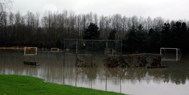
The National Weather Service placed the crest-mark for the North Fork of the Stilly near 17.5 feet at around 4 p.m. that day. The “ponding” was evident not only in the farm fields lining Highway 530, but also the partially swamped soccer and baseball fields of Twin Rivers Park just east of Arlington. At the same time, Highway 530 itself remained completely clear of water runoff, both in the stretch of road adjoining Twin Rivers Park and at Island Crossing at the intersection of I-5, both of which are flood-prone areas.